MeteoMast IJmuiden
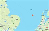
TNO carried out measurements on the IJmuiden measuring mast from 2011-2016. This measuring mast was built by RWE in the autumn of 2011, 40 nautical miles from the coast west of IJmuiden. Sensors are mounted at various heights that detect and record wind speed, wind direction, temperature and pressure differences. This met mast has been dismantled, but the data is still available via this website.
Introduction
The Wind Energy department of TNO Energy & Materials Transition has been granted in 2011 by the Ministry of Economic Affairs, Agriculture and Innovation (EL&I) to carry out a four-year meteorological measurement program in the Dutch part of the North Sea. The aim was to collect better wind data that could be used in the preparations for the new offshore wind farms in the areas designated in the National Water Plan. Because the wind supply is one of the most important variables when calculating the yields of these future parks, it was very important to collect more reliable wind data. Ultimately, this will lead to more certainty and fewer risks for investors, which will result in lower costs.
Because wind measurements were already being carried out on various platforms in the North Sea, but at heights that were too low, a measurement setup has been chosen to meet future developments in offshore wind.
This measurement campaign was stopped in 2016.
Sensors and measurement campaign
In order to carry out the aforementioned measuring program, TNO rented the met mast from RWO, which was built 40 nautical miles (approx. 75 km) off the coast west of IJmuiden. Sensors were mounted at various heights (between 25 and 100 meters) that could detect and record wind speed, wind direction, temperature and pressure differences.
A ZX LIDAR had also been installed, which laser beams measure wind speeds and wind directions at heights up to 300 meters above the met mast.
TNO carried out measurements on the IJmuiden measuring mast for 4 years (from 2011-2016).
Cantilevers were placed at three different heights in the directions 0, 120 and 240 degrees. Sensors were mounted on the top of the mast, on these outriggers and on the roof of the measuring container for measuring wind speed, wind direction, air pressure, temperature, precipitation and relative humidity.
In addition to the signals from the sensors in the mast, the LiDAR in the mast provides wind speeds and wind directions at heights far above. The measuring heights of the LiDAR were 90, 115, 140, 165, 190, 215, 240, 265, 290 and 315 meters.
To build up more knowledge for the future for safe design and cost-efficient foundations for wind turbines, a wave buoy was placed in the sea to measure current and wave properties.
All historical measurement data can still be obtained via this website. MMIJ
The results of the research were also used in the research and development program of the FLOW consortium (Far and Large Offshore Wind).
Instrumentation report
The instrumentation report can be viewed via the link below.
FLOW consortium
The FLOWprogram was started in 2009 by the Dutch companies and institutes Essent-RWE, Eneco, TenneT, Ballast Nedam, Van Oord, IHC Merwede, 2-B Energy, XEMC Darwind, TNO and TU Delft. The partners wrote a business plan that enables Dutch companies to take a leading position in the international market of offshore wind farms. Apart from the opportunities for employment, the Dutch government wants to reach the target for renewable energy (14% in 2020) using the growth of offshore wind farms. The foal of the FLOW program is to reduce cost of energy for far offshore wind by 20% in 2015 (with respect to 2010). The knowledge of and experience with farms far offshore in deep waters are limited. FLOW wants to increase the reliability of these wind farms, speed up the developments and at the same time reduce costs and risks.
The Met Mast IJmuiden was a first step. The mast was installed by Van Oord, on behalf of RWE. TNO was responsible for installing and managing the measuring equipment and carrying out the measurements. TNO was also responsible for managing all measurement data and making public data available.
Data
To download the data from Meetmast IJmuiden (MMIJ), you will be redirected to the registration page, after registration, the data is accessible.